Geographic information systems (GIS) skills are worth building when your job involves answering “where” questions: where to put a facility, where risk is concentrated, where assets need attention. GIS training is not just about producing maps. It teaches you to manage spatial data, run the kind of analysis that supports a real decision, and present findings that non-technical stakeholders can act on. The people who get the most value are analysts, planners, project managers, and anyone responsible for location-based decisions. If your work rarely touches a map, a full GIS course will cover more than you actually need.
Many managers only think of GIS as mapping software, something nice to look at but hard to act on. That reputation usually comes from maps produced without a decision attached to them: visually impressive, but disconnected from any choice a leader actually has to make. Training built around decision support flips that around. It starts from the question a manager needs answered, then designs the spatial analysis, the database and the final map to answer exactly that question, which is why the skills below are worth separating out from software features.
What will you be able to do afterwards?
After a solid GIS training course, you should be able to do more than open a mapping application and click around. You will be able to build and maintain a spatial database, choose the right data model for a given problem, and run the analysis techniques that turn raw location data into evidence a manager can actually use. Specifically, you should walk away able to:
- Prepare, clean and manage spatial and attribute data pulled from multiple sources
- Build suitability models and run multi-criteria analysis to support a site or project decision
- Produce project monitoring maps and status views that track progress over time, by location
- Design and query spatial databases, including integration with existing enterprise systems
- Present spatial findings as a short, decision-ready brief instead of handing over a raw map
- Digitise and maintain an asset inventory so maintenance and operations teams can rely on it day to day
These are workplace outcomes, not software features. A course that only teaches you which buttons to click will not get you to any of them.
Who is it for, and who is it not for?
GIS training fits planners responsible for land use, infrastructure or service-coverage proposals, who need to justify a recommendation with spatial evidence rather than a map alone. It fits project managers who have to track where capital works stand and report that status clearly to people who were not on site. It fits GIS specialists and data analysts who are formalising skills they already use informally, tightening up how they manage data and models rather than learning from scratch. It also fits asset and utility teams who manage networks spread across a wide geographic area and need maintenance and inventory systems that are current and easy to search, rather than a map that is redrawn from memory every time something changes.
It is a weaker fit for people whose decisions never depend on location, or whose organisation already has a dedicated GIS team producing everything the business needs. In that case, a short briefing from that team will usually answer the question faster than a full course would. It is also not the right starting point for someone who needs general data analysis skills rather than spatial ones specifically. A broader analytics course will serve that need better than a GIS-focused one, and taking the GIS route first will mean learning a layer of spatial concepts you do not need yet.
How do you apply GIS skills on a live project?
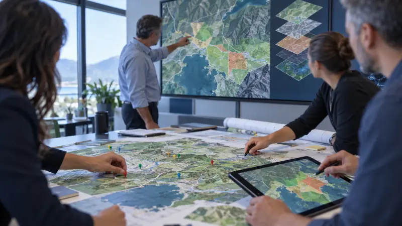
Picture a mid-sized organisation choosing between three possible sites for a new facility. Without GIS skills, the choice is often made from a handful of criteria compared informally: distance to a main road, nearby land use, a rough sense of demand. With GIS skills, the same decision starts from a suitability model. Each site is scored against weighted criteria such as access, utility coverage, environmental constraints and proximity to demand, and the result is a ranked shortlist with the reasoning attached, instead of a confident guess that is hard to defend later if the choice is questioned.
The same approach carries into delivery once the site is chosen. A project monitoring map tracks what has actually been built against what was planned, broken down by location, so a manager can see which section of a project is behind schedule without reading through a long written status report. For organisations that manage physical assets spread across a wide area, such as pipelines, cables or meters, the same spatial database that supported the original site decision becomes the record used every day afterwards: planning maintenance rounds, responding to faults, and feeding accurate asset data into the enterprise systems the business already runs, instead of a spreadsheet that nobody fully trusts.
Which GIS course fits your role?
Not every GIS course teaches the same thing, so match the course to the decision you actually need to make rather than the broadest option on the page. If you want the fundamentals in one place — spatial data, GIS software, database management and core analysis techniques — the Mastering Geographic Information Systems (GIS) Training Course builds that foundation and is the right starting point if you are new to the subject.
If your role is about defending a decision to management — choosing a site, prioritising a project, presenting spatial evidence to leadership — the Advanced GIS for Management Decision Support and Project Planning Course is built around exactly that output: a usable spatial decision brief for a real site or project choice, not a general tour of the software.
If you are responsible for infrastructure that spans a wide area — electricity, water or gas networks — and need the asset side covered specifically, GIS for Utility Assets: Management & Enterprise Integration focuses on network data modelling, asset digitisation and connecting that data to the ERP and customer information systems your organisation already depends on.
Bottom line: GIS skills pay off wherever a real decision depends on location: where to build, where to invest, where to send a maintenance crew next. The return is not the map itself but the quality of the decision sitting behind it. Match the course to the decision you need to make rather than defaulting to the broadest option, and the time away from work will show up in better-justified choices afterwards. Check the course page for the full syllabus, upcoming dates and fees.
Frequently asked questions
Do I need an IT or technical background to learn GIS?
No. Most GIS training is built for planners, project managers and analysts rather than programmers. You need comfort with spreadsheets and basic data concepts; the course itself teaches the spatial database and mapping skills on top of that.
What is the difference between using GIS occasionally and being a GIS specialist?
Occasional users read maps and pull simple reports that someone else built. A specialist builds and maintains the spatial database, designs the analysis models, and sets up the systems that occasional users rely on day to day.
Can GIS skills be useful without dedicated mapping software already installed?
Yes. The decision-making skills, such as structuring a suitability model or designing a spatial database, apply regardless of which software a team eventually uses, so the training still pays off ahead of a software purchase.
How is GIS training different from a general data analytics course?
General analytics training covers data of any kind. GIS training adds the spatial layer: coordinate systems, spatial databases, and analysis methods such as suitability modelling that only make sense once location is part of the data.
What is the most common mistake teams make with GIS data?
Treating a map as the final product instead of a step toward a decision. A map without a clear question behind it rarely changes what a team does; the valuable output is the decision brief the map supports.