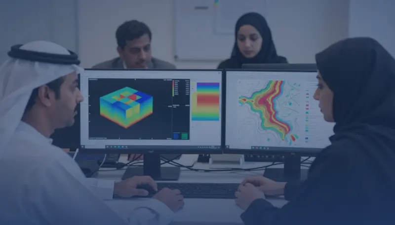
Applied Geostatistics Kriging Software Training Course

At a glance
- Duration
- 1 Week
- Format
- Classroom
- Cities
- Doha, Manama, Casablanca, Abu Dhabi, Kuala Lumpur, Munich and more
- Next session
- 18 – 22 October 2026, Doha
- Average fee
- 5,800 €
Overview
Applied Geostatistics and Kriging Software Training Course is a one-week course for GIS analysts, geologists, engineers, planners, and spatial data analysts, who leave with a Spatial Estimation and Validation Portfolio. Participants prepare spatial samples, examine spatial autocorrelation, model variograms, configure kriging, compare interpolation methods, quantify prediction uncertainty, validate estimates, and produce defensible maps and reports. The course emphasizes decisions supported by diagnostics rather than software defaults. Agile Leaders Training Center develops applied geostatistics and kriging capability.
Who Should Attend
- Spatial analysis functions responsible for preparing, exploring, and modeling location-based measurements
- Geoscience functions responsible for estimating mineral, reservoir, soil, or groundwater properties
- Environmental functions responsible for mapping contamination, exposure, habitat, or monitoring observations
- Engineering and planning functions responsible for interpreting spatial surfaces in project decisions
- Data functions responsible for validating geospatial models and communicating uncertainty
The course assumes participants can work with tabular and mapped spatial data in GIS software, and leaves out introductory GIS navigation, remote-sensing classification, advanced stochastic simulation, and software programming.
Departments and Industries
The course supports departments and industries that estimate conditions between sampled locations.
- Geographic information systems, spatial analytics, and digital mapping
- Geology, mining, petroleum, and groundwater functions
- Environment, agriculture, land management, and natural resources
- Engineering, infrastructure, utilities, and urban planning
- Research, quality assurance, and technical consulting
Learning Objectives
By the end of this course, participants will be able to:
- Prepare spatial samples and diagnose distribution, trend, and outliers
- Analyze spatial autocorrelation with empirical semivariograms
- Build and compare fitted variogram models and search neighborhoods
- Apply deterministic interpolation and ordinary or universal kriging
- Evaluate predictions through cross-validation and uncertainty measures
- Produce defensible estimation maps and technical reports
Course Agenda
Day 1: Prepare and Explore Spatial Data
- Spatial Sample Data Readiness Checklist
- Coordinate Reference and Measurement Review
- Distribution, Transformation, and Outlier Diagnostics
- Trend Surface and Directional Pattern Analysis
- Exploratory Spatial Data Analysis Record
Day 2: Model Spatial Dependence
- Spatial Autocorrelation Concept Map
- Empirical Semivariogram Construction Method
- Nugget, Sill, and Range Interpretation
- Anisotropy and Directional Variogram Analysis
- Variogram Model Fitting Decision Log
Day 3: Build Spatial Predictions
- Inverse Distance Weighting Benchmark Surface
- Ordinary Kriging Model Configuration
- Universal Kriging Trend Configuration
- Search Neighborhood and Sector Design
- Prediction and Standard Error Surface Generation
Day 4: Validate and Communicate Estimates
- Leave-One-Out Cross-Validation Procedure
- Mean Error and Root Mean Square Error Review
- Observed-versus-Predicted Diagnostic Plot
- Interpolation Method Comparison Matrix
- Uncertainty Map and Reporting Protocol
Day 5: Practice Geostatistical Decision Support
- Exercise: Diagnose a Spatial Sampling Dataset
- Exercise: Fit and Challenge a Variogram Model
- Exercise: Compare IDW and Kriging Surfaces
- Exercise: Validate Predictions and Map Uncertainty
- Capstone: Spatial Estimation and Validation Portfolio
Practical Exercises
The course uses suggested activities based on environmental, mining, groundwater, agriculture, and infrastructure datasets.
- Suggested activity: inspect coordinates, distributions, outliers, trends, and sampling density before modeling.
- Suggested activity: construct directional semivariograms and record justified nugget, sill, range, and anisotropy choices.
- Suggested activity: configure competing interpolation models and compare cross-validation diagnostics.
- Suggested activity: create prediction and uncertainty maps with an evidence-based technical recommendation.
FAQs
Who suits applied geostatistics and kriging software training, and what does it assume?
GIS, geoscience, environmental, engineering, planning, and spatial-data functions suit the training; it assumes practical experience handling tabular and mapped spatial observations in GIS software.
How does applied geostatistics differ from general GIS analysis training?
Applied geostatistics models spatial dependence, predicts values between samples, and quantifies uncertainty, while general GIS analysis covers a wider range of mapping, overlay, proximity, network, and data-management tasks.
What is a semivariogram used for in kriging analysis?
A semivariogram describes how similarity between observations changes with separation distance and direction, supporting selection of the spatial correlation model and kriging weights.
How are kriging predictions validated?
Kriging predictions are validated by withholding observations, predicting their values, comparing predictions with measurements, and reviewing bias, error magnitude, standardized diagnostics, spatial patterns, and model sensitivity.
Why should spatial prediction uncertainty be mapped?
Spatial prediction uncertainty should be mapped because an estimated surface alone can hide where sampling support is weak and where decisions require caution, additional samples, or a different model.
Conclusion
Participants take back a Spatial Estimation and Validation Portfolio containing data checks, exploratory findings, variogram decisions, interpolation configurations, validation diagnostics, prediction surfaces, uncertainty maps, and a technical recommendation. It changes software-led interpolation into a traceable analytical workflow. The portfolio supports review, comparison, reporting, and defensible use of spatial estimates.
credits: 5 credit per day
Course Mode: full-time
Provider: Agile Leaders Training Center
-
Events for this Course
-
Doha 18 – 22 October 2026
-
Manama 25 – 29 October 2026
-
Casablanca 26 – 30 October 2026
-
Abu Dhabi 26 – 30 October 2026
-
Kuala Lumpur 2 – 6 November 2026
-
Munich 9 – 13 November 2026
-
Dubai 16 – 20 November 2026
-
London 16 – 20 November 2026
-
Cairo 23 – 27 November 2026
-
Jakarta 23 – 27 November 2026
-
Geneva 29 November – 3 December 2026
-
Montreux 7 – 11 December 2026
-
Tbilisi 14 – 18 December 2026
-
Johannesburg 20 – 24 December 2026
-
Milan 28 December 2026 – 1 January 2027
-
Barcelona 4 – 8 January 2027
-
Cape town 10 – 14 January 2027
-
Cairo 11 – 15 January 2027
-
Bali 17 – 21 January 2027
-
Abu Dhabi 18 – 22 January 2027
-
Trabzon 24 – 28 January 2027
-
Madrid 1 – 5 February 2027
-
Frankfurt 1 – 5 February 2027
-
Marbella 7 – 11 February 2027
-
Paris 8 – 12 February 2027
-
Zanzibar 14 – 18 February 2027
-
Singapore 15 – 19 February 2027
-
Dubai 22 – 26 February 2027
-
Milan 22 – 26 February 2027
-
London 1 – 5 March 2027
-
Vienna 8 – 12 March 2027
-
Istanbul 15 – 19 March 2027
-
Amman 21 – 25 March 2027
-
Abu Dhabi 22 – 26 March 2027
-
Rome 29 March – 2 April 2027
-
Kuwait 4 – 8 April 2027
-
Kuala Lumpur 12 – 16 April 2027
-
Porto 12 – 16 April 2027
-
Amsterdam 19 – 23 April 2027
-
Sharm El-Sheikh 26 – 30 April 2027
-
Accra 2 – 6 May 2027
-
Madrid 10 – 14 May 2027
-
Nice 10 – 14 May 2027
-
Bangkok 16 – 20 May 2027
-
Dubai 24 – 28 May 2027
-
Prague 31 May – 4 June 2027
-
London 7 – 11 June 2027
-
Abu Dhabi 7 – 11 June 2027
-
Amsterdam 14 – 18 June 2027
-
Istanbul 21 – 25 June 2027
-
Berlin 21 – 25 June 2027
-
Baku 28 June – 2 July 2027
-
Phuket 4 – 8 July 2027
-
Lisbon 5 – 9 July 2027
-
Tokyo 12 – 16 July 2027
-
New York 12 – 16 July 2027
-
Manama 18 – 22 July 2027
-
Nairobi 25 – 29 July 2027
-
London 2 – 6 August 2027
-
Chicago 8 – 12 August 2027
-
Tashkent 8 – 12 August 2027
-
Toronto 15 – 19 August 2027
-
Dubai 16 – 20 August 2027
-
Langkawi 22 – 26 August 2027
-
Rome 30 August – 3 September 2027
-
Muscat 5 – 9 September 2027
-
Barcelona 6 – 10 September 2027
-
San Diego 13 – 17 September 2027
-
Vienna 20 – 24 September 2027
-
Seoul 20 – 24 September 2027
-
Athens 27 September – 1 October 2027
-
Amsterdam 4 – 8 October 2027
-
Zoom 11 – 15 October 2027
-
Paris 18 – 22 October 2027
| Image | Location | Dates | Duration | Mode | Price | Actions |
|---|---|---|---|---|---|---|

|
Doha |
Week 42, 2026 18 – 22 October 2026 |
1 Week | Onsite | €5,500 | |

|
Manama |
Week 43, 2026 25 – 29 October 2026 |
1 Week | Onsite | €4,700 | |

|
Casablanca |
Week 44, 2026 26 – 30 October 2026 |
1 Week | Onsite | €4,100 | |

|
Abu Dhabi |
Week 44, 2026 26 – 30 October 2026 |
1 Week | Onsite | €4,700 | |

|
Kuala Lumpur |
Week 45, 2026 2 – 6 November 2026 |
1 Week | Onsite | €5,200 | |

|
Munich |
Week 46, 2026 9 – 13 November 2026 |
1 Week | Onsite | €5,700 | |

|
Dubai |
Week 47, 2026 16 – 20 November 2026 |
1 Week | Onsite | €4,500 | |

|
London |
Week 47, 2026 16 – 20 November 2026 |
1 Week | Onsite | €5,700 | |

|
Cairo |
Week 48, 2026 23 – 27 November 2026 |
1 Week | Onsite | €4,100 | |

|
Jakarta |
Week 48, 2026 23 – 27 November 2026 |
1 Week | Onsite | €5,700 | |

|
Geneva |
Week 48, 2026 29 November – 3 December 2026 |
1 Week | Onsite | €6,200 | |

|
Montreux |
Week 50, 2026 7 – 11 December 2026 |
1 Week | Onsite | €7,500 | |

|
Tbilisi |
Week 51, 2026 14 – 18 December 2026 |
1 Week | Onsite | €5,000 | |

|
Johannesburg |
Week 51, 2026 20 – 24 December 2026 |
1 Week | Onsite | €4,500 | |

|
Milan |
Week 53, 2026 28 December 2026 – 1 January 2027 |
1 Week | Onsite | €5,700 | |

|
Barcelona |
Week 01, 2027 4 – 8 January 2027 |
1 Week | Onsite | €5,700 | |

|
Cape town |
Week 01, 2027 10 – 14 January 2027 |
1 Week | Onsite | €4,500 | |
|
|
Cairo |
Week 02, 2027 11 – 15 January 2027 |
1 Week | Onsite | €4,100 | |

|
Bali |
Week 02, 2027 17 – 21 January 2027 |
1 Week | Onsite | €5,700 | |
|
|
Abu Dhabi |
Week 03, 2027 18 – 22 January 2027 |
1 Week | Onsite | €4,700 |
Frequently asked questions
What does this course cover?
OverviewApplied Geostatistics and Kriging Software Training Course is a one-week course for GIS analysts, geologists, engineers, planners, and spatial data analysts, who leave with a Spatial Estimation and Validation Portfolio. Participants prepare spatial samples, examine spatial autocorrelation, model variograms, configure kriging, compare interpolation…
Are training dates available?
Yes. Available dates and destinations are listed in the course dates section on this page.
How can I register?
Choose an available date on this page and complete the registration form, or send a programme enquiry.
Can I download the course brochure?
Yes. Use the brochure download link provided on this page.
This course by city
- Data Analytics Training and Data Science Courses in Abu Dhabi
- Data Analytics Training and Data Science Courses in Accra
- Data Analytics Training and Data Science Courses in Amman
- Data Analytics Training and Data Science Courses in Amsterdam
- Data Analytics Training and Data Science Courses in Athens
- Data Analytics Training and Data Science Courses in Baku
- Data Analytics Training and Data Science Courses in Bali
- Data Analytics Training and Data Science Courses in Bangkok
- Data Analytics Training and Data Science Courses in Barcelona
- Data Analytics Training and Data Science Courses in Berlin
- Data Analytics Training and Data Science Courses in Cairo
- Data Analytics Training and Data Science Courses in Cape town
- Data Analytics Training and Data Science Courses in Casablanca
- Data Analytics Training and Data Science Courses in Chicago
- Data Analytics Training and Data Science Courses in Doha
- Data Analytics Training and Data Science Courses in Dubai
- Data Analytics Training and Data Science Courses in Frankfurt
- Data Analytics Training and Data Science Courses in Geneva
- Data Analytics Training and Data Science Courses in Istanbul
- Data Analytics Training and Data Science Courses in Jakarta
- Data Analytics Training and Data Science Courses in Johannesburg
- Data Analytics Training and Data Science Courses in Kuala Lumpur
- Data Analytics Training and Data Science Courses in Kuwait
- Data Analytics Training and Data Science Courses in Langkawi
- Data Analytics Training and Data Science Courses in Lisbon
- Data Analytics Training and Data Science Courses in London
- Data Analytics Training and Data Science Courses in Madrid
- Data Analytics Training and Data Science Courses in Manama
- Data Analytics Training and Data Science Courses in Marbella
- Data Analytics Training and Data Science Courses in Milan
- Data Analytics Training and Data Science Courses in Montreux
- Data Analytics Training and Data Science Courses in Munich
- Data Analytics Training and Data Science Courses in Muscat
- Data Analytics Training and Data Science Courses in Nairobi
- Data Analytics Training and Data Science Courses in New York
- Data Analytics Training and Data Science Courses in Nice
- Data Analytics Training and Data Science Courses in Paris
- Data Analytics Training and Data Science Courses in Phuket
- Data Analytics Training and Data Science Courses in Porto
- Data Analytics Training and Data Science Courses in Prague
- Data Analytics Training and Data Science Courses in Rome
- Data Analytics Training and Data Science Courses in San Diego
- Data Analytics Training and Data Science Courses in Seoul
- Data Analytics Training and Data Science Courses in Sharm El-Sheikh
- Data Analytics Training and Data Science Courses in Singapore
- Data Analytics Training and Data Science Courses in Tashkent
- Data Analytics Training and Data Science Courses in Tbilisi
- Data Analytics Training and Data Science Courses in Tokyo
- Data Analytics Training and Data Science Courses in Toronto
- Data Analytics Training and Data Science Courses in Trabzon
- Data Analytics Training and Data Science Courses in Vienna
- Data Analytics Training and Data Science Courses in Zanzibar
- Data Analytics Training and Data Science Courses in Zoom