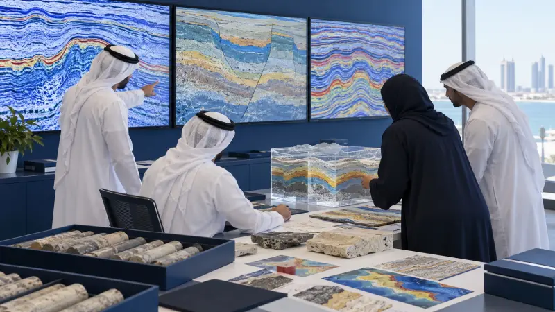
Applied Reservoir Geostatistics Training Course
At a glance
- Duration
- 5 days
- Format
- Classroom
- Cities
- Athens, Prague, Johannesburg, Geneva, Chicago, Kuala Lumpur and more
- Next session
- 12 – 16 October 2026, Athens
- Average fee
- 7,550 €
Overview
Applied Geostatistics for Reservoir Property Modeling Training Course is a five-day advanced course for reservoir engineering, geoscience, geomodeling, petrophysics, and subsurface analysis functions who leave with a Reservoir Geostatistics Modeling and Uncertainty Pack. Participants connect spatial data conditioning, variograms, kriging, facies modeling, property simulation, uncertainty ranking, validation, volumetric implications, and decision evidence. Agile Leaders Training Center develops practical applied reservoir geostatistics and property modeling capability.
Who Should Attend
- Reservoir engineering functions responsible for static-model inputs and uncertainty decisions
- Geoscience functions responsible for spatial interpretation and depositional context
- Geomodeling functions responsible for facies and petrophysical property realizations
- Petrophysics functions responsible for conditioned well-log properties and cutoffs
- Subsurface analysis functions responsible for model validation and decision evidence
The course assumes participants can interpret well logs, maps, basic statistics, reservoir units, and three-dimensional grids, and leaves out introductory geology, seismic processing, dynamic simulation, software certification, and reserves classification.
Departments and Industries
The course supports departments and industries that characterize subsurface spatial variability.
- Oil and gas reservoir characterization
- Energy subsurface development planning
- Carbon storage site modeling
- Groundwater aquifer characterization
- Mining resource estimation support
Learning Objectives
By the end of this course, participants will be able to:
- Analyze spatial distributions and data conditioning choices
- Build and interpret directional variogram models
- Apply kriging estimation and diagnostic methods
- Build facies and property simulation workflows
- Evaluate realizations, uncertainty, and validation evidence
- Build a reservoir geostatistics decision pack
Course Agenda
Day 1: Condition Spatial Reservoir Data
- Reservoir Modeling Objective and Scale Map
- Well Data Quality and Support Review
- Univariate Distribution and Outlier Profile
- Declustering and Sampling Bias Assessment
- Coordinate, Zone, and Grid Alignment Checklist
Day 2: Model Spatial Continuity
- Experimental Variogram Calculation Workflow
- Directional Anisotropy Analysis Map
- Nugget, Sill, and Range Interpretation Guide
- Nested Variogram Model Fitting Sheet
- Geological Continuity Consistency Review
Day 3: Estimate Reservoir Properties
- Neighborhood Search and Sample Selection Plan
- Ordinary Kriging Estimation System
- Indicator Kriging Probability Model
- Kriging Variance and Diagnostic Map
- Cross-Validation Error and Bias Report
Day 4: Simulate Facies and Properties
- Facies Proportion and Trend Model
- Sequential Indicator Simulation Workflow
- Sequential Gaussian Simulation Workflow
- Property Transform and Back-Transform Control
- Realization Ranking and Uncertainty Dashboard
Day 5: Practice Model Validation
- Exercise: Condition and Declutter Well Data
- Exercise: Fit a Directional Variogram
- Exercise: Compare Kriging and Simulation Results
- Exercise: Validate Facies and Property Realizations
- Capstone: Reservoir Geostatistics Modeling and Uncertainty Pack
Practical Exercises
The course uses suggested activities based on petroleum reservoirs, carbon storage, groundwater, and mineral-resource datasets.
- Suggested activity: condition spatial samples and document scale, support, declustering, and grid decisions.
- Suggested activity: calculate directional variograms and fit geologically consistent nested models.
- Suggested activity: compare kriging estimates with stochastic facies and property realizations.
- Suggested activity: assemble validation, ranking, uncertainty, and decision evidence into the final pack.
FAQs
Who suits applied reservoir geostatistics training, and what does it assume?
Reservoir engineering, geoscience, geomodeling, petrophysics, and subsurface analysis functions suit the training; it assumes experience with well logs, maps, basic statistics, reservoir units, and three-dimensional grids.
How does reservoir geostatistics differ from general statistical analysis?
Reservoir geostatistics models spatial dependence, direction, scale, neighborhood, estimation, simulation, and geological continuity, while general statistical analysis may summarize distributions without representing spatial location and connectivity.
Why is variogram modeling important for reservoir properties?
Variogram modeling describes how similarity changes with distance and direction, supplying continuity parameters for kriging and simulation while allowing geological anisotropy and short-scale variability to be represented.
When should reservoir teams use kriging or stochastic simulation?
Kriging supports a locally weighted estimate, while stochastic simulation produces multiple spatially plausible realizations; teams choose according to whether the decision needs a single estimate or uncertainty distributions and connectivity alternatives.
How are reservoir property realizations validated?
Realizations are validated against input distributions, variograms, facies proportions, trends, well conditioning, cross-validation evidence, geological concepts, volumetric ranges, and decision-relevant uncertainty measures.
Conclusion
Participants take back a Reservoir Geostatistics Modeling and Uncertainty Pack linking conditioned data, spatial continuity, kriging, facies simulation, property simulation, validation, ranking, and decision evidence. It changes isolated spatial calculations into a traceable reservoir-model workflow. The pack supports coordinated work across geoscience, petrophysics, geomodeling, reservoir engineering, and development planning.
credits: 5 credit per day
Course Mode: full-time
Provider: Agile Leaders Training Center
-
Events for this Course
-
Athens 12 – 16 October 2026
-
Prague 19 – 23 October 2026
-
Johannesburg 25 – 29 October 2026
-
Zoom 2 – 6 November 2026
-
Geneva 8 – 12 November 2026
-
Chicago 8 – 12 November 2026
-
Kuala Lumpur 16 – 20 November 2026
-
Marbella 29 November – 3 December 2026
-
Sharm El-Sheikh 30 November – 4 December 2026
-
Accra 6 – 10 December 2026
-
Trabzon 13 – 17 December 2026
-
Vienna 21 – 25 December 2026
-
Kuwait 27 – 31 December 2026
-
Barcelona 28 December 2026 – 1 January 2027
-
Tbilisi 4 – 8 January 2027
-
Munich 11 – 15 January 2027
-
London 18 – 22 January 2027
-
Madrid 25 – 29 January 2027
-
Phuket 31 January – 4 February 2027
-
Nairobi 21 – 25 February 2027
-
Porto 22 – 26 February 2027
-
Nice 1 – 5 March 2027
-
Jakarta 8 – 12 March 2027
-
Langkawi 14 – 18 March 2027
-
Montreux 15 – 19 March 2027
-
Muscat 21 – 25 March 2027
-
Cairo 22 – 26 March 2027
-
Abu Dhabi 29 March – 2 April 2027
-
Milan 5 – 9 April 2027
-
Amman 18 – 22 April 2027
-
Berlin 26 – 30 April 2027
-
Tashkent 2 – 6 May 2027
-
San Diego 3 – 7 May 2027
-
Bali 9 – 13 May 2027
-
Seoul 24 – 28 May 2027
-
Dubai 31 May – 4 June 2027
-
Baku 7 – 11 June 2027
-
Zanzibar 13 – 17 June 2027
-
Amsterdam 21 – 25 June 2027
-
London 28 June – 2 July 2027
-
Lisbon 28 June – 2 July 2027
-
Doha 4 – 8 July 2027
-
Manama 11 – 15 July 2027
-
Abu Dhabi 12 – 16 July 2027
-
Frankfurt 19 – 23 July 2027
-
Paris 2 – 6 August 2027
-
Rome 9 – 13 August 2027
-
New York 9 – 13 August 2027
-
Dubai 16 – 20 August 2027
-
Casablanca 30 August – 3 September 2027
-
Istanbul 6 – 10 September 2027
-
Toronto 12 – 16 September 2027
-
Tokyo 20 – 24 September 2027
-
Singapore 20 – 24 September 2027
-
Bangkok 3 – 7 October 2027
-
Cape town 17 – 21 October 2027
| Image | Location | Dates | Duration | Mode | Price | Actions |
|---|---|---|---|---|---|---|

|
Porto |
Week 08, 2027 22 – 26 February 2027 |
5 Days | Onsite | €6,500 | |

|
Nice |
Week 09, 2027 1 – 5 March 2027 |
5 Days | Onsite | €8,000 | |

|
Jakarta |
Week 10, 2027 8 – 12 March 2027 |
5 Days | Onsite | €8,000 | |

|
Langkawi |
Week 10, 2027 14 – 18 March 2027 |
5 Days | Onsite | €8,000 | |
|
Montreux |
Week 11, 2027 15 – 19 March 2027 |
5 Days | Onsite | €8,000 | |

|
Muscat |
Week 11, 2027 21 – 25 March 2027 |
5 Days | Onsite | €6,500 | |

|
Cairo |
Week 12, 2027 22 – 26 March 2027 |
5 Days | Onsite | €5,200 | |

|
Abu Dhabi |
Week 13, 2027 29 March – 2 April 2027 |
5 Days | Onsite | €6,500 | |

|
Milan |
Week 14, 2027 5 – 9 April 2027 |
5 Days | Onsite | €7,000 | |

|
Amman |
Week 15, 2027 18 – 22 April 2027 |
5 Days | Onsite | €6,000 | |

|
Berlin |
Week 17, 2027 26 – 30 April 2027 |
5 Days | Onsite | €6,500 | |

|
Tashkent |
Week 17, 2027 2 – 6 May 2027 |
5 Days | Onsite | €8,000 | |

|
San Diego |
Week 18, 2027 3 – 7 May 2027 |
5 Days | Onsite | €16,000 | |

|
Bali |
Week 18, 2027 9 – 13 May 2027 |
5 Days | Onsite | €6,500 | |

|
Seoul |
Week 21, 2027 24 – 28 May 2027 |
5 Days | Onsite | €12,000 | |

|
Dubai |
Week 22, 2027 31 May – 4 June 2027 |
5 Days | Onsite | €6,500 | |

|
Baku |
Week 23, 2027 7 – 11 June 2027 |
5 Days | Onsite | €8,000 | |

|
Zanzibar |
Week 23, 2027 13 – 17 June 2027 |
5 Days | Onsite | €6,000 | |

|
Amsterdam |
Week 25, 2027 21 – 25 June 2027 |
5 Days | Onsite | €6,500 | |

|
London |
Week 26, 2027 28 June – 2 July 2027 |
5 Days | Onsite | €6,500 |
Frequently asked questions
What does this course cover?
OverviewApplied Geostatistics for Reservoir Property Modeling Training Course is a five-day advanced course for reservoir engineering, geoscience, geomodeling, petrophysics, and subsurface analysis functions who leave with a Reservoir Geostatistics Modeling and Uncertainty Pack. Participants connect spatial data conditioning, variograms, kriging, facies m…
Are training dates available?
Yes. Available dates and destinations are listed in the course dates section on this page.
How can I register?
Choose an available date on this page and complete the registration form, or send a programme enquiry.
Can I download the course brochure?
Yes. Use the brochure download link provided on this page.
This course by city
- Oil & Gas Training and Other Technical Courses in Abu Dhabi
- Oil & Gas Training and Other Technical Courses in Accra
- Oil & Gas Training and Other Technical Courses in Amman
- Oil & Gas Training and Other Technical Courses in Amsterdam
- Oil & Gas Training and Other Technical Courses in Athens
- Oil & Gas Training and Other Technical Courses in Baku
- Oil & Gas Training and Other Technical Courses in Bali
- Oil & Gas Training and Other Technical Courses in Bangkok
- Oil & Gas Training and Other Technical Courses in Barcelona
- Oil & Gas Training and Other Technical Courses in Berlin
- Oil & Gas Training and Other Technical Courses in Cairo
- Oil & Gas Training and Other Technical Courses in Cape town
- Oil & Gas Training and Other Technical Courses in Casablanca
- Oil & Gas Training and Other Technical Courses in Chicago
- Oil & Gas Training and Other Technical Courses in Doha
- Oil & Gas Training and Other Technical Courses in Dubai
- Oil & Gas Training and Other Technical Courses in Frankfurt
- Oil & Gas Training and Other Technical Courses in Geneva
- Oil & Gas Training and Other Technical Courses in Istanbul
- Oil & Gas Training and Other Technical Courses in Jakarta
- Oil & Gas Training and Other Technical Courses in Johannesburg
- Oil & Gas Training and Other Technical Courses in Kuala Lumpur
- Oil & Gas Training and Other Technical Courses in Kuwait
- Oil & Gas Training and Other Technical Courses in Langkawi
- Oil & Gas Training and Other Technical Courses in Lisbon
- Oil & Gas Training and Other Technical Courses in London
- Oil & Gas Training and Other Technical Courses in Madrid
- Oil & Gas Training and Other Technical Courses in Manama
- Oil & Gas Training and Other Technical Courses in Marbella
- Oil & Gas Training and Other Technical Courses in Milan
- Oil & Gas Training and Other Technical Courses in Montreux
- Oil & Gas Training and Other Technical Courses in Munich
- Oil & Gas Training and Other Technical Courses in Muscat
- Oil & Gas Training and Other Technical Courses in Nairobi
- Oil & Gas Training and Other Technical Courses in New York
- Oil & Gas Training and Other Technical Courses in Nice
- Oil & Gas Training and Other Technical Courses in Paris
- Oil & Gas Training and Other Technical Courses in Phuket
- Oil & Gas Training and Other Technical Courses in Porto
- Oil & Gas Training and Other Technical Courses in Prague
- Oil & Gas Training and Other Technical Courses in Rome
- Oil & Gas Training and Other Technical Courses in San Diego
- Oil & Gas Training and Other Technical Courses in Seoul
- Oil & Gas Training and Other Technical Courses in Sharm El-Sheikh
- Oil & Gas Training and Other Technical Courses in Singapore
- Oil & Gas Training and Other Technical Courses in Tashkent
- Oil & Gas Training and Other Technical Courses in Tbilisi
- Oil & Gas Training and Other Technical Courses in Tokyo
- Oil & Gas Training and Other Technical Courses in Toronto
- Oil & Gas Training and Other Technical Courses in Trabzon
- Oil & Gas Training and Other Technical Courses in Vienna
- Oil & Gas Training and Other Technical Courses in Zanzibar
- Oil & Gas Training and Other Technical Courses in Zoom