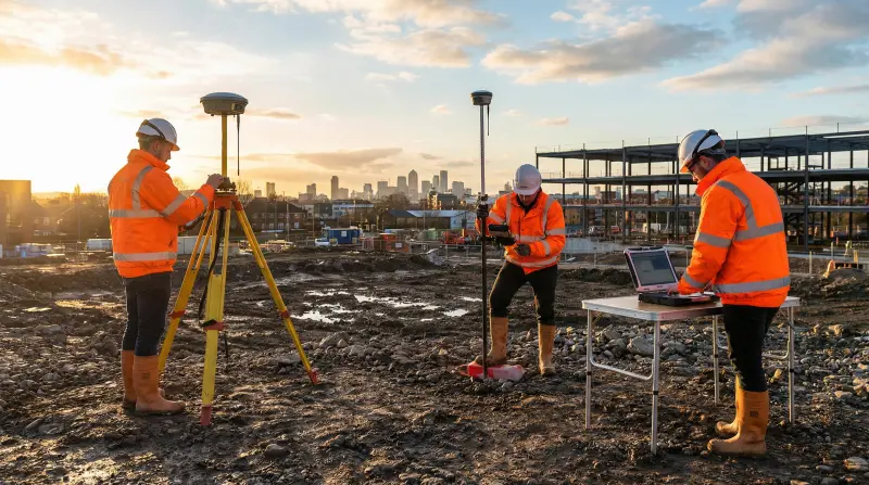
GPS and GNSS Field Data Applications Course
At a glance
- Duration
- 1 Week
- Format
- Classroom
- Cities
- Barcelona, Montreux, London, Phuket, Dubai, Madrid and more
- Next session
- 2 – 6 November 2026, Barcelona
- Average fee
- 5,750 €
Overview
GPS and GNSS Field Data and Software Applications Training Course is a one-week professional course for GIS specialists, survey technicians and field teams, who leave with a GNSS Field-to-Map Workflow and Quality Pack. The course connects positioning fundamentals, coordinate references, field planning, structured collection, correction, software processing, GIS integration and reporting. Participants document accuracy influences and validation evidence instead of relying on fixed accuracy claims. Agile Leaders Training Center develops practical geospatial data capability.
Who Should Attend
- GIS specialists importing and validating field observations
- Survey technicians collecting GPS and GNSS data
- Field engineers recording assets, sites and inspection locations
- Mapping professionals integrating points, tracks and attributes
- Asset and operations teams reviewing location-data quality
The course assumes basic computer and mapping literacy. It excludes advanced geodetic-network adjustment, hydrographic surveying, drone photogrammetry and single-vendor product certification.
Departments and Industries
The course supports organisations that collect and use location data for mapping, assets and field operations.
- Geographic information systems and spatial analytics
- Engineering, construction and infrastructure
- Utilities, transport and telecommunications
- Environmental, agricultural and land-management teams
- Emergency services, logistics and field inspection
Learning Objectives
By the end of this course, participants will be able to:
- Explain GPS and GNSS positioning and major error sources
- Select coordinate systems, datums and reference-frame metadata
- Plan field observations around geometry and site constraints
- Capture points, tracks, attributes and observation records consistently
- Import, correct, process and validate field data in geospatial software
- Produce mapped outputs and a traceable field-data quality report
Course Agenda
Day 1: GPS and GNSS Positioning Fundamentals
- Satellite Ranging and Position Solution Diagram
- GPS, GNSS, Receiver and Antenna Function Map
- Satellite Geometry and Dilution of Precision Review
- Blockage, Multipath and Atmospheric Error Register
- Positioning Method and Accuracy Requirement Matrix
Day 2: Coordinate References and Field Planning
- Geographic and Projected Coordinate System Comparison
- Datum, Reference Frame, Epoch and Height Concepts
- Project Coordinate Reference and Metadata Sheet
- Observation Schedule and Site Constraint Assessment
- Receiver, Antenna and Field-Control Checklist
Day 3: Structured Field Data Collection
- Point, Waypoint, Track and Feature Collection Plan
- Attribute Schema and Data Dictionary Design
- Antenna Height, Setup and Observation Log
- Field Quality Indicators and Acceptance Checks
- Exception, Revisit and Evidence Register
Day 4: Correction and Software Processing
- Differential, RTK and Post-Processing Workflow Comparison
- Raw Observation and RINEX File Review
- Reference Data, Base Station and Correction Inputs
- Import, Transformation and Processing Sequence
- Residual, Precision and Quality-Control Evidence
Day 5: GIS Integration and Reporting Practice
- Exercise: Validate Coordinate Reference Metadata
- Exercise: Import and Inspect Field Features
- Exercise: Review Corrected Positions and Exceptions
- Exercise: Build a Map, Attribute Table and Quality Summary
- Capstone: GNSS Field-to-Map Workflow and Quality Pack
Practical Exercises
Suggested activities use asset inventory, infrastructure inspection and environmental field-data scenarios.
- Suggested activity: assess a site for blockage, multipath and geometry risks
- Suggested activity: create a field schema and observation log
- Suggested activity: compare uncorrected and processed position evidence
- Suggested activity: reconcile field metadata with mapped GIS output
FAQs
Who should take GPS software applications training?
GPS software applications training suits field, survey, GIS and asset professionals who need to move location observations from collection through processing, validation, mapping and reporting.
What factors affect GPS and GNSS accuracy?
Position quality depends on satellite geometry, signal blockage, multipath, atmospheric effects, receiver and antenna characteristics, setup, observation method, correction inputs and data-processing decisions.
Why do coordinate systems and datums matter?
Coordinate systems and datums define how positions relate to the earth and a map. Incorrect or missing reference metadata can shift features or make datasets appear inconsistent when combined.
Does the course teach one GPS software product?
No. The course teaches transferable steps for planning, collection, import, correction, processing, GIS integration and quality reporting. Interface details can vary between receiver and software products.
Conclusion
Participants take back a GNSS Field-to-Map Workflow and Quality Pack containing a coordinate-reference sheet, field plan, data dictionary, observation log, processing sequence, validation checks, mapped output and quality report. The pack helps teams make collection and software decisions traceable from the field observation to the final map.
credits: 5 credit per day
Course Mode: full-time
Provider: Agile Leaders Training Center
-
Events for this Course
-
Barcelona 2 – 6 November 2026
-
Montreux 2 – 6 November 2026
-
London 9 – 13 November 2026
-
Phuket 15 – 19 November 2026
-
Dubai 16 – 20 November 2026
-
Madrid 23 – 27 November 2026
-
Abu Dhabi 23 – 27 November 2026
-
Toronto 6 – 10 December 2026
-
Amsterdam 7 – 11 December 2026
-
Geneva 20 – 24 December 2026
-
Nairobi 20 – 24 December 2026
-
Paris 28 December 2026 – 1 January 2027
-
San Diego 28 December 2026 – 1 January 2027
-
Kuala Lumpur 4 – 8 January 2027
-
Milan 11 – 15 January 2027
-
Berlin 11 – 15 January 2027
-
Tbilisi 18 – 22 January 2027
-
Abu Dhabi 25 – 29 January 2027
-
Tokyo 1 – 5 February 2027
-
Tashkent 7 – 11 February 2027
-
Trabzon 14 – 18 February 2027
-
Rome 15 – 19 February 2027
-
Barcelona 22 – 26 February 2027
-
Chicago 28 February – 4 March 2027
-
Jakarta 1 – 5 March 2027
-
Manama 7 – 11 March 2027
-
Kuwait 14 – 18 March 2027
-
Istanbul 15 – 19 March 2027
-
Cape town 21 – 25 March 2027
-
Dubai 22 – 26 March 2027
-
Vienna 29 March – 2 April 2027
-
Lisbon 29 March – 2 April 2027
-
Prague 5 – 9 April 2027
-
Abu Dhabi 5 – 9 April 2027
-
Amsterdam 12 – 16 April 2027
-
Muscat 18 – 22 April 2027
-
Cairo 19 – 23 April 2027
-
London 26 – 30 April 2027
-
Baku 10 – 14 May 2027
-
Athens 10 – 14 May 2027
-
Amman 16 – 20 May 2027
-
Langkawi 23 – 27 May 2027
-
Frankfurt 24 – 28 May 2027
-
Johannesburg 30 May – 3 June 2027
-
Paris 7 – 11 June 2027
-
Casablanca 14 – 18 June 2027
-
Marbella 20 – 24 June 2027
-
London 21 – 25 June 2027
-
Rome 28 June – 2 July 2027
-
Abu Dhabi 28 June – 2 July 2027
-
Dubai 5 – 9 July 2027
-
Vienna 12 – 16 July 2027
-
Seoul 12 – 16 July 2027
-
Istanbul 19 – 23 July 2027
-
New York 19 – 23 July 2027
-
Lagos 1 – 5 August 2027
-
Milan 2 – 6 August 2027
-
Bali 8 – 12 August 2027
-
Cairo 16 – 20 August 2027
-
Munich 16 – 20 August 2027
-
Accra 22 – 26 August 2027
-
Madrid 23 – 27 August 2027
-
Sharm El-Sheikh 30 August – 3 September 2027
-
Porto 30 August – 3 September 2027
-
Zanzibar 5 – 9 September 2027
-
Amsterdam 13 – 17 September 2027
-
Addis Ababa 13 – 17 September 2027
-
London 20 – 24 September 2027
-
Dubai 27 September – 1 October 2027
-
Kuala Lumpur 4 – 8 October 2027
-
Singapore 4 – 8 October 2027
-
Zoom 18 – 22 October 2027
-
Doha 24 – 28 October 2027
-
Bangkok 24 – 28 October 2027
-
Manama 31 October – 4 November 2027
-
Nice 1 – 5 November 2027
| Image | Location | Dates | Duration | Mode | Price | Actions |
|---|---|---|---|---|---|---|
|
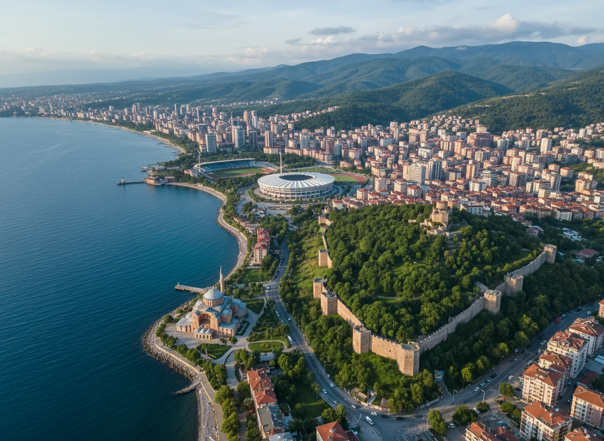
Trabzon |
Week 06, 2027 14 – 18 February 2027 |
1 Week | Onsite | €6,800 | |

|
Rome |
Week 07, 2027 15 – 19 February 2027 |
1 Week | Onsite | €5,700 | |

|
Barcelona |
Week 08, 2027 22 – 26 February 2027 |
1 Week | Onsite | €5,700 | |

|
Chicago |
Week 08, 2027 28 February – 4 March 2027 |
1 Week | Onsite | €12,000 | |

|
Jakarta |
Week 09, 2027 1 – 5 March 2027 |
1 Week | Onsite | €5,700 | |

|
Manama |
Week 09, 2027 7 – 11 March 2027 |
1 Week | Onsite | €4,700 | |

|
Kuwait |
Week 10, 2027 14 – 18 March 2027 |
1 Week | Onsite | €5,500 | |

|
Istanbul |
Week 11, 2027 15 – 19 March 2027 |
1 Week | Onsite | €4,500 | |

|
Cape town |
Week 11, 2027 21 – 25 March 2027 |
1 Week | Onsite | €4,500 | |

|
Dubai |
Week 12, 2027 22 – 26 March 2027 |
1 Week | Onsite | €4,500 | |

|
Vienna |
Week 13, 2027 29 March – 2 April 2027 |
1 Week | Onsite | €5,700 | |

|
Lisbon |
Week 13, 2027 29 March – 2 April 2027 |
1 Week | Onsite | €5,700 | |

|
Prague |
Week 14, 2027 5 – 9 April 2027 |
1 Week | Onsite | €6,000 | |

|
Abu Dhabi |
Week 14, 2027 5 – 9 April 2027 |
1 Week | Onsite | €4,700 | |

|
Amsterdam |
Week 15, 2027 12 – 16 April 2027 |
1 Week | Onsite | €5,700 | |

|
Muscat |
Week 15, 2027 18 – 22 April 2027 |
1 Week | Onsite | €5,700 | |

|
Cairo |
Week 16, 2027 19 – 23 April 2027 |
1 Week | Onsite | €4,100 | |

|
London |
Week 17, 2027 26 – 30 April 2027 |
1 Week | Onsite | €5,700 | |

|
Baku |
Week 19, 2027 10 – 14 May 2027 |
1 Week | Onsite | €5,000 | |

|
Athens |
Week 19, 2027 10 – 14 May 2027 |
1 Week | Onsite | €6,700 |
Frequently asked questions
What does this course cover?
OverviewGPS and GNSS Field Data and Software Applications Training Course is a one-week professional course for GIS specialists, survey technicians and field teams, who leave with a GNSS Field-to-Map Workflow and Quality Pack. The course connects positioning fundamentals, coordinate references, field planning, structured collection, correction, software p…
Are training dates available?
Yes. Available dates and destinations are listed in the course dates section on this page.
How can I register?
Choose an available date on this page and complete the registration form, or send a programme enquiry.
Can I download the course brochure?
Yes. Use the brochure download link provided on this page.
This course by city
- Data Analytics Training and Data Science Courses in Abu Dhabi
- Data Analytics Training and Data Science Courses in Accra
- Data Analytics Training and Data Science Courses in Addis Ababa
- Data Analytics Training and Data Science Courses in Amman
- Data Analytics Training and Data Science Courses in Amsterdam
- Data Analytics Training and Data Science Courses in Athens
- Data Analytics Training and Data Science Courses in Baku
- Data Analytics Training and Data Science Courses in Bali
- Data Analytics Training and Data Science Courses in Bangkok
- Data Analytics Training and Data Science Courses in Barcelona
- Data Analytics Training and Data Science Courses in Berlin
- Data Analytics Training and Data Science Courses in Cairo
- Data Analytics Training and Data Science Courses in Cape town
- Data Analytics Training and Data Science Courses in Casablanca
- Data Analytics Training and Data Science Courses in Chicago
- Data Analytics Training and Data Science Courses in Doha
- Data Analytics Training and Data Science Courses in Dubai
- Data Analytics Training and Data Science Courses in Frankfurt
- Data Analytics Training and Data Science Courses in Geneva
- Data Analytics Training and Data Science Courses in Istanbul
- Data Analytics Training and Data Science Courses in Jakarta
- Data Analytics Training and Data Science Courses in Johannesburg
- Data Analytics Training and Data Science Courses in Kuala Lumpur
- Data Analytics Training and Data Science Courses in Kuwait
- Data Analytics Training and Data Science Courses in Lagos
- Data Analytics Training and Data Science Courses in Langkawi
- Data Analytics Training and Data Science Courses in Lisbon
- Data Analytics Training and Data Science Courses in London
- Data Analytics Training and Data Science Courses in Madrid
- Data Analytics Training and Data Science Courses in Manama
- Data Analytics Training and Data Science Courses in Marbella
- Data Analytics Training and Data Science Courses in Milan
- Data Analytics Training and Data Science Courses in Montreux
- Data Analytics Training and Data Science Courses in Munich
- Data Analytics Training and Data Science Courses in Muscat
- Data Analytics Training and Data Science Courses in Nairobi
- Data Analytics Training and Data Science Courses in New York
- Data Analytics Training and Data Science Courses in Nice
- Data Analytics Training and Data Science Courses in Paris
- Data Analytics Training and Data Science Courses in Phuket
- Data Analytics Training and Data Science Courses in Porto
- Data Analytics Training and Data Science Courses in Prague
- Data Analytics Training and Data Science Courses in Rome
- Data Analytics Training and Data Science Courses in San Diego
- Data Analytics Training and Data Science Courses in Seoul
- Data Analytics Training and Data Science Courses in Sharm El-Sheikh
- Data Analytics Training and Data Science Courses in Singapore
- Data Analytics Training and Data Science Courses in Tashkent
- Data Analytics Training and Data Science Courses in Tbilisi
- Data Analytics Training and Data Science Courses in Tokyo
- Data Analytics Training and Data Science Courses in Toronto
- Data Analytics Training and Data Science Courses in Trabzon
- Data Analytics Training and Data Science Courses in Vienna
- Data Analytics Training and Data Science Courses in Zanzibar
- Data Analytics Training and Data Science Courses in Zoom