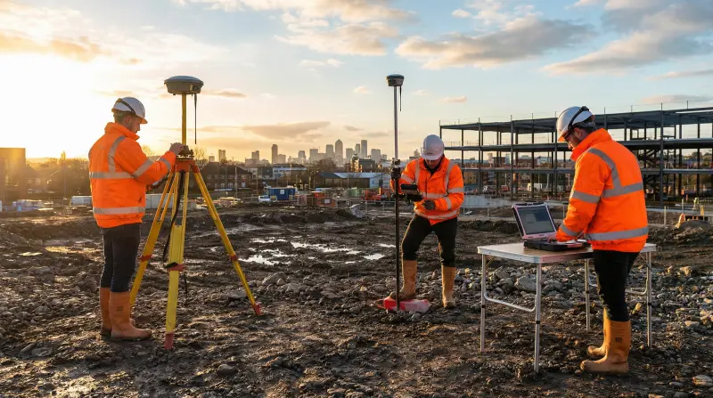
GNSS receivers make precision surveying faster, but they also make it easier to be precisely wrong. A base point set over the wrong mark, a rover pole held at the wrong height, or a fixed solution accepted without checking what kind of fix it actually is can all hand a team numbers that look clean and are not. The mistakes are rarely about the hardware. They are almost always about the routine around it: what gets checked, what gets logged, and what gets assumed instead of verified.
What Are the Most Common GNSS Surveying Mistakes?
Most errors in GNSS precision surveying trace back to a handful of repeating habits, not equipment failure.
- Antenna height recorded carelessly. A slipped tape, a rounded number, or a height entered for the wrong antenna model turns a centimeter-level observation into a point that is simply off, with nothing in the data to flag it.
- Multipath and obstruction ignored. Working close to metal structures, vehicles, dense canopy or reflective cladding lets signals bounce before they reach the antenna. The receiver still reports a fix; the position underneath it is degraded.
- Accepting a float fix as if it were fixed. A float solution can be accurate to the decimeter level, not the centimeter level a precision survey needs. Treating the two the same is one of the fastest ways to pass bad coordinates downstream.
- Stale or unverified base coordinates. A base set up from an old, unverified, or mistyped control point carries its error into every point observed from it, silently and consistently.
- Mixing datums and projections mid-project. Combining data collected in different horizontal or vertical datums, or in a geographic and a projected system, without a documented transformation step, produces offsets that only show up once the data is combined with someone else's.
- Short occupation times under poor conditions. Cutting observation time to save a few minutes, especially under a weak satellite geometry or elevated ionospheric activity, leaves little redundancy to catch a bad fix.
- No independent check point. Without a known point surveyed again as a control check at the start or end of a session, a systematic error in the setup can run through an entire day's work unnoticed.
None of these require new equipment to fix. They require a team that treats the setup, the check, and the log as part of the survey itself, not as paperwork around it.
What Will Your Team Be Able to Do After Fixing These Habits?
Closing these gaps is a skills problem as much as a process one. A team that has worked through GNSS positioning, kinematic surveying and geodetic control systematically can:
- Choose correctly between real-time kinematic, differential and post-processed workflows for a given job, instead of defaulting to whatever was used last time.
- Set up and verify a base station against known control before trusting anything it broadcasts.
- Recognize when a fix type, satellite geometry or multipath condition is too weak to accept, and know what to do instead of pushing on.
- Carry a dataset cleanly through a datum or projection transformation, with the transformation documented so the next person can trust it.
- Build occupation and check-point routines into topographic, boundary and environmental mapping work so errors surface before the deliverable is signed off, not after.
- Process mobile and kinematic GNSS mapping data with an understanding of where its accuracy genuinely holds and where it does not.
The GNSS Precision Surveying & Mapping Techniques course builds exactly this: the GNSS positioning, real-time kinematic and differential GNSS surveying skills, and the data-processing judgment, that turn a receiver into a reliable survey tool rather than a source of plausible-looking error.
Who Is This For, and Who Is It Not For?
This is most useful for surveyors, geospatial analysts, civil engineers, environmental consultants and mapping specialists who already use GNSS equipment in the field but learned its finer points on the job, picking up habits from whoever trained them rather than from a structured review of what can go wrong. It is also valuable for project managers in geospatial or infrastructure teams who need to understand why a dataset is being questioned or reworked, even if they are not the one holding the rover.
It is less useful for someone who has never used a GNSS receiver and needs to start with the basics of satellite positioning, or for a team whose work is entirely desk-based GIS analysis with no field data collection of its own. For those groups, a general introduction to positioning systems, or a course built around GIS analysis rather than field survey technique, is the better starting point.
How Does Bad Survey Data Travel Into Maintenance and Asset Decisions?
Consider a facilities or industrial site where survey teams capture the as-built positions of underground utilities, structural elements or fixed equipment. If that positioning carries an unflagged error, it does not stay inside the survey report. It becomes the reference point a maintenance team uses to locate equipment, the coordinate a reliability engineer attaches to a condition reading, or the baseline an asset register relies on for years afterward. A mistake that took minutes to make in the field can take far longer to notice once it is embedded in someone else's planning data.
This is why accurate GNSS work and sound maintenance and reliability practice sit closer together than they first appear. Teams that manage physical assets increasingly rely on precise location and condition data feeding into their planning: knowing exactly where equipment sits, and trusting the readings tied to that location, shapes how work gets prioritized. The AI-Assisted Maintenance and Reliability Engineering Course works from the other end of that chain, helping teams interpret asset condition signals, prioritize interventions and govern reliability decisions that ultimately rest on data no more reliable than the survey or inspection that produced it.
The same logic applies further down the maintenance function. The Mastering Maintenance Fundamentals Training Course covers the planning and scheduling work that depends on knowing exactly where equipment is and what condition it is in, while the Mastering Preventive and Predictive Maintenance: A Course for Engineers and Managers course builds the condition-monitoring and predictive-maintenance skills that turn accurate location and condition data into an actual maintenance plan rather than a static record. Good survey discipline is the first link in that chain; these courses build the links that come after it.
Bottom Line
Most GNSS precision surveying mistakes are not about the receiver. They are about antenna heights nobody double-checked, fixes nobody questioned, datums nobody documented, and control points nobody re-verified. A team that builds the habit of checking these, and the skill to know what a questionable fix actually looks like, turns GNSS from a source of quiet, expensive errors into a dependable source of data that everyone downstream, including the maintenance and reliability teams who rely on it, can trust. Check the course page for the full syllabus, upcoming dates and fees.
Frequently asked questions
What is the real difference between RTK and post-processed GNSS data when it comes to mistakes?
Real-time kinematic surveying gives an answer in the field immediately, so a bad fix can be caught and redone on the spot. Post-processed data looks solid until it is checked back in the office, which is why a documented occupation log matters just as much as the raw observation.
Can a GNSS receiver report a fixed solution and still be wrong?
Yes. A fix type describes the mathematical solution the receiver settled on, not an independent guarantee of accuracy. A fix taken over a reflective surface or a short baseline can still carry an error large enough to matter for precision work.
Does a single bad GNSS reading matter if most of the dataset is fine?
It can. A single mis-recorded antenna height or an unflagged multipath point rarely stands out on its own, but once it is merged into a wider dataset, a control network, or someone else's asset map, it is difficult to isolate and even harder to trust once found.
Is checking against an independent control point only necessary on large projects?
No. A short re-check against a known point is just as useful on a single-day job, since it is the fastest way to confirm the whole setup, not just the final point, was correct.
Do office-based GIS teams need to understand field GNSS mistakes?
It helps. A GIS analyst who understands where positioning errors originate is better placed to question a dataset that looks slightly off, rather than treating every coordinate as equally reliable.
What is the first habit worth fixing if a team's GNSS data has been unreliable?
Start with the occupation routine: recording antenna height and type consistently, and checking a known control point at the start of every session. Most other mistakes become easier to catch once that habit is in place.